THEORY
The word tomography is derived from the Greek word tomos, which means to slice or section. Tomography involves the non-invasive imaging of a solid body like a human body, or a geologic structure. Tomographic imaging can be conducted on practically any scale. Tomography involves dividing the body in question into cubes called voxels, with the goal of estimating some characteristic value of the solid for each cell, so that a complete image can be generated.

In Geology Passive Seismic Tomography has been mainly used for Crust and Mantle studies using medium to large size earthquakes (source dimensions hundreds of m or Km!) and an array of widely spaced seismological Stations.
PASSIVE SEISMIC TOMOGRAPHY DEFINITION
The use of microearthquakes – natural or induced- in order to provide information about subsurface in large exploration areas or reservoir scale problems using travel times of P- and S- waves to a network of special designed seismometers at the surface.
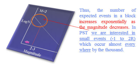
microearthquakes occur almost everywhere
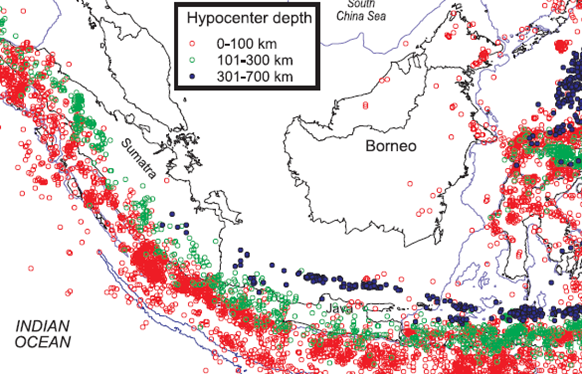
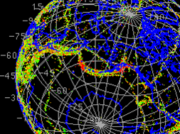
Indonesia is particularly suited for PST(Passive Seismic Tomography) surveys
GUTENBERG RICHTER SEISMIC RATE LAW
The number N of seismic events that occur in a region with Magnitude greater than M follows the Gutenberg Richter rule:
LogN=a-bM
where a,b are constants depending on the tectonics of the region.
PASSIVE TOMOGRAPHY IS A USEFUL TOOL TO:
- Investigate new large areas for exploration (not depended on topography)
- Environmentally friendly (particularly suited for rainforest, National parks, swamp investigations etc.)
- Improve imaging and mapping in areas with seismic penetration problems (e.g. Basalt barriers) since seismic sources are below or within the target
- Optimize the design 3D and 2D survey lines
- Extremely more economical in relation to conventional seismic
PASSIVE SEISMIC, WHY?


Tinggalkan komentar